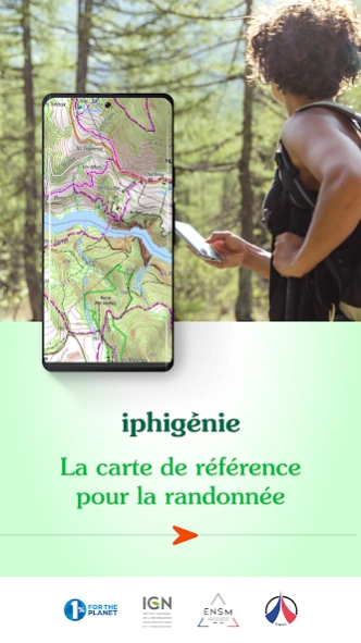
About Iphigénie | The Hiking Map App
Iphigénie is the hiking map app for outdoor enthusiasts in France and around the world. Perfect for individuals (hikers, trailers, bikers, horse riders…) and professionals (guides, firefighters, surveyors, airmen,...
Iphigénie is the hiking map app for outdoor enthusiasts in France and around the world. Perfect for individuals (hikers, trailers, bikers, horse riders…) and professionals (guides, firefighters, surveyors, airmen, sailors, etc.) who need accurate maps.
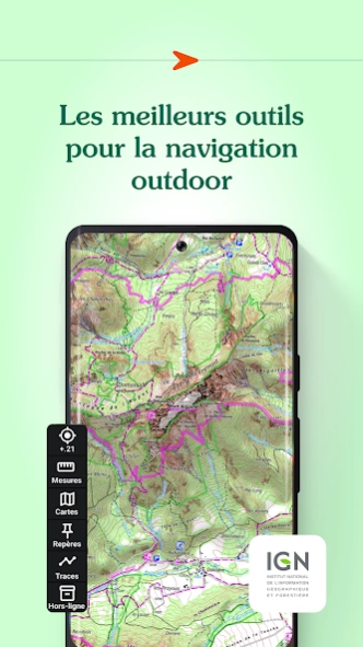
Find more than 40 detailed topographic basemaps (including IGN maps, SwissTopo, IGN Spain, OpenTopo, OpenSnow, land registry, slope inclination), even while offline.
BEFORE YOUR OUTING
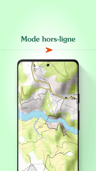
- Prepare your outing by downloading maps to access them offline
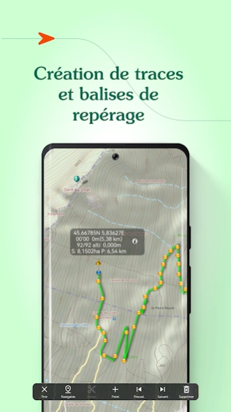
- Create, edit and import tracks
- Create and import markers (e.g. mushroom spots, departure points of routes, etc.)
- Print sections of the map if you need to
- Search for a specific location by name or by GPS details
- Access routes or landmarks from IGNRando or Data-Avalanche
- Access a 3D view and slope inclinations
DURING YOUR OUTING
- Geolocate yourself on the basemap of your choice
- Follow routes using GPS, without worrying about network availability
- Record your track
- Access real-time information such as distance traveled, elevation (±), average speed, current speed, estimated time of arrival, etc.
- Activate the beacon function to allow your loved ones to follow your progress in real-time
- Create specific voice alerts to guide you, even with your iPhone/Android in your pocket
AFTER YOUR OUTING
- Create groups of tracks/landmarks
- Store and backup all your data in the Cloud
- Export your GPS tracks and landmarks in GPX format
- Share your outings and landmarks with all your friends
Download the free basic app
Download the basic application for free on your smartphone. This version allows you to be geolocated on one of the 25 free base maps such as Open Topo Map, Open Cycle Map, Open Snow map. The world is within reach!
You will also have access to real-time information such as your position/course/altitude/speed.
Download the complete app with the “Iphigénie Carto” subscription
The Iphigénie Carto subscription is €24.99 per year. It gives you access to 40 base maps including those of IGN. These maps can be downloaded on your Android device (phone, tablet) so that you can access them even without a network.
You also have access to the full potential of Iphigénie by finding all the features mentioned above.
Good to know: you have 7 days to test the complete app for free.
List of available maps:
- IGN France
- SwissTopo
- IGN Spain
- IGN Belgium
- BKG Germany
- Kartverket Norway
- Cartographic Institute of Catalunya
- OpenTopo
- OpenCycle
- OpenSnow
- ICAO
- ESRI
- Satellite view
- Cadastre
- Slope inclination
- Restricted areas for drones
- Historical maps of France
- Geological and mining maps (France)
- National Forestry Office
We donate 1% of our turnover to 1% for the Planet to help preserve the environment.
MADE IN FRANCE
Previous Versions
Here you can find the changelog of Iphigénie | The Hiking Map App since it was posted on our website on 2013-08-23 02:41:14.
The latest version is 10.11.3 and it was updated on 2024-04-25 16:03:57. See below the changes in each version.
Iphigénie | The Hiking Map App version 10.11.3
Updated At: 2024-04-18
Changes: 8 new Swisstopo layers!
Iphigénie | The Hiking Map App version 10.10.6
Updated At: 2024-04-02
Changes: Various bug fixes and improvements.
Iphigénie | The Hiking Map App version 10.10.5
Updated At: 2024-03-19
Changes: What's new:
- OACI map based on the new IGN digital platform
- 3D view based on the new IGN digital platform
- POI and track Elevation features based on the new IGN digital platform
- Removed obsolete layers: ESRI & Littoral
- Fix: Biotope layer not displayed anymore
- Fix: Barometer calibration firing IGN elevation requests in an infite loop at startup.
Iphigénie | The Hiking Map App version 10.7.1
Updated At: 2024-01-19
Changes: The french winter hikes layer produced by the Petzl fondation in collaboration with IGN is now available.
Iphigénie | The Hiking Map App version 10.7.7
Updated At: 2024-01-19
Changes: Brand new POI search.
Iphigénie | The Hiking Map App version 10.6.14
Updated At: 2023-12-07
Changes: New POI reverse geocoding.
Iphigénie | The Hiking Map App version 10.6.13
Updated At: 2023-12-07
Changes: Technical improvements.
Iphigénie | The Hiking Map App version 10.6.11
Updated At: 2023-10-04
Changes: Restore access to some maps.
Iphigénie | The Hiking Map App version 10.6.7
Updated At: 2023-09-28
Changes: Workaround for the IGN maps issue faced by some users.
Iphigénie | The Hiking Map App version 10.6.2
Updated At: 2023-07-27
Changes: Performance issue fix
Android 5 minimum
Disclaimer
Official Google Play Link
We do not host Iphigénie | The Hiking Map App on our servers. We did not scan it for viruses, adware, spyware or other type of malware. This app is hosted by Google and passed their terms and conditions to be listed there. We recommend caution when installing it.
The Google Play link for Iphigénie | The Hiking Map App is provided to you by apps112.com without any warranties, representations or guarantees of any kind, so access it at your own risk.
If you have questions regarding this particular app contact the publisher directly. For questions about the functionalities of apps112.com contact us.